
Positional shift (map symbols)
Text author: Luděk Krtička Last update: 2022-10-26
If the mapped objects of the same type are close to each other in the terrain, this often results in a positional shift of map symbols due to their size and the requirement for minimum gaps to ensure the legibility of the situation on the map.
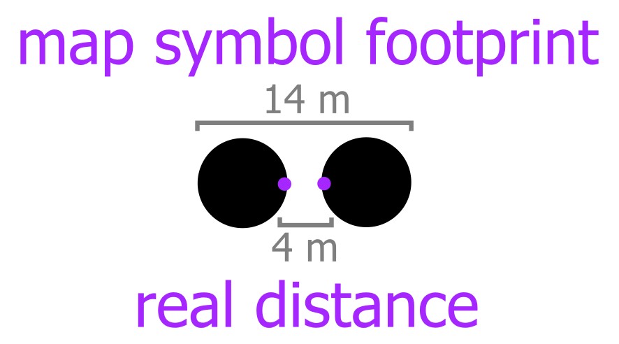
Consider the example of two boulders (each 1 metre high and 1 metre wide) located 2 metres apart. The total distance between the outer edges of the boulders will therefore be 4 metres. However, if they are mapped, due to the size of the map symbol and the minimum distance required between symbols of the same colour, the measured distance and area covered is much greater and positional shift is applied to the map symbols. Let’s do the math: boulder symbol size 0.4 mm + minimum gap size 0.15 mm + boulder symbol size 0.4 mm is 0.95 mm in total for a map scale of 1:15000. Or 6 m + 2.25 m + 6 m = 14.25 m real footprint projected onto terrain.
Some orienteering mapping programs allows to show legibility halo or use special white colour around symbols to indicate required minimum distance according to IOF map specifications. Use of such settings helps to draw objects of the same colour with correct minimum distance between them directly in terrain.